
September 2024
COW LLC Supports Hurricane Helene Relief with Develop Air HP
iVue Robotics (September 2024) — When Hurricane Helene struck North Carolina last year, the storm left behind widespread flooding, damaged infrastructure, and communities struggling to recover. In the days that followed, COW LLC, led by Chris Strout, deployed the Develop Air HP drone platform to support disaster relief efforts. Using aerial imagery, flood plain mapping, and 3D modeling, the drones provided first responders with critical information that helped speed recovery and improve safety on the ground.
COW LLC logo

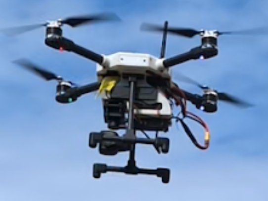
Close-up of a Develop Air HP drone
COW LLC’s technology gave first responders a faster way to gather and share critical information in the chaotic days following the storm. Instead of relying only on ground reports, emergency managers could use aerial data to see the full scope of flooding, prioritize which neighborhoods needed help first, and plan safe routes for rescue crews.
Chris Strout, who oversaw the deployment, said the experience showed how drones can fill an important gap in disaster response. By combining high-resolution imagery with advanced modeling, the Develop Air HP system allowed local officials to act with greater confidence and reduce delays in getting aid where it was needed most.
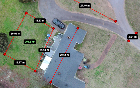
Beyond immediate flood assessments, the Develop Air HP system also supported long-term recovery by creating detailed 3D models of damaged neighborhoods and infrastructure. These models gave engineers and local planners the ability to evaluate structural risks, plan repairs, and allocate resources with greater precision.
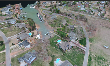
The versatility of the platform allowed it to serve multiple roles during the response. In addition to flood mapping, the drones were used for residential imagery, roof inspections, and debris monitoring, giving relief coordinators a comprehensive picture of conditions on the ground. By combining multiple data layers into a single system, COW LLC provided a clearer roadmap for both short-term relief and long-term rebuilding.
3D modeling from Develop Air HP gave planners a detailed view of storm-damaged neighborhoods.
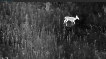
Thermal imaging from Develop Air HP supported search and rescue operations.
Overall, COW LLC’s work after Hurricane Helene underscores how drone technology is becoming a critical tool in emergency response. Develop Air HP was not built for everyday use, but its adaptability in the field proved essential for mapping flood zones, supporting search and rescue, and guiding long-term recovery. By combining advanced imagery with open-source flexibility, COW LLC has shown how drones can bridge the gap between first response and rebuilding, setting the stage for broader adoption in future disasters.
If you want to learn more about COW LLC and the Develop Air HP system, be sure to visit the COW LLC website and explore their work in disaster recovery, 3D modeling, and residential imagery. To see their latest projects and capabilities, visit cow.ventures.